
Soil Analysis
The following descriptions outline methods for describing and analyzing soils. The initial step is selecting site and making a soil pit. The next steps, outlined below, describe what information is typically collected in a soil pit and how analysis of the information helps in understanding various soil uses and dynamics.
Making a soil pit: Identifying and describing the study area involves three steps.
|
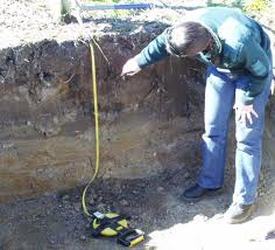
Pit Method: Students dig a soil pit approximately 1 meter deep (or until an impenetrable layer is reached) and as big around as is necessary to easily observe all of the soil horizons from the bottom to the top of the pit (approximately 1.5 x 1.5 m wide). In some situations, students may be able to perform the soil characterization measurements at a site where the soil profile has already been exposed through human or natural action (e.g., a road cut or the side of a ravine). In these instances, teachers need to make sure that the site is safe for students and there is no objection to them scraping the surface soil away to expose a fresh soil face.
|
- Digging is much easier when the soil is moist. If possible, plan digging shortly after a rain.
- As soil is removed from the pit, place it carefully in piles representing each of the natural layers as they occur in the profile.
- The removed soil can be put on a tarp or other type of plastic sheet to make cleaning up the site easier.
- Cover piles of removed soil with plastic to prevent them from eroding away.
- Contact a local soil scientist or other professional who may be willing to assist you in digging a pit and helping describe the characteristics of the soil profile.
- When finished with the soil characterization measurements, the horizons need to be replaced into the soil pit in reverse order (last one out should be first one back in).
|
Defining the Soil Characterization Site
|
|
Porcedure:
- Use a trowel to scrape a few centimeters of soil off of the profile to expose a fresh soil face.
- Determine whether the soil profile is moist, wet, or dry. If the soil profile is dry, moisten it with the spray mist bottle.
- Start at the top of the profile and observe the characteristics of the soil moving towards the bottom of the profile. Mark each layer ( use a nail or golf tee) at the top and bottom of each horizon. Be sure there is a consensus regarding the definition of the layer boundaries.
- Look carefully at the soil profile for distinguishing characteristics such as color, texture, shapes, roots, rocks, small dark nodules (called concretions), worms, small animals, insects, and worm channels. These observations will help to define the horizons.
- Measure the top and bottom depth of each horizon beginning at the top (surface) of the profile. Start with the meter stick or tape measure at 0 cm at the top of the profile. Note the depths at which each horizon starts and ends.
- Record the top and bottom depth of each horizon.
- Categorize each horizon on the basis of the definitions outlined below.
|
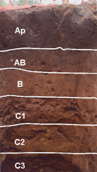
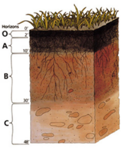
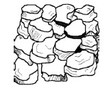
Classifying the soil layer
O) Organic matter. Litter layer of plant residues in relatively undecomposed form. A) Surface soil.Layer of mineral soil with most organic matter accumulation and life within the soil. This layer eluviates (is depleted of) iron, clay and alunimum, organic compounds, and other soluble constituents. When eluviation is pronounced, a lighter colored "E" subsurface soil horizon is apparent at the base of the "A" horizon. A-horizons may also be the result of a combination of soil bioturbation and surface processes that winnow fine particles from biologically mounded topsoil. In this case, the A-horizon is regarded as a "biomantle". B) Subsoil This layer accumulates iron, clay, aluminum and organic compounds, a process referred to as illuviation. C) Parent material: Layer of large unbroken rocks. This layer may accumulate the more soluble compounds These layers may also be divided into multiple layers. They would be refered to as B1,B2,and B3 respectively. |
Aalysis of Each Layer
An analysis of the soil characteristics are completed For each layer in a horizon. This includes:
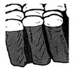
Soil structure: Soil structure is the shape that soils take based on physical and chemical properties. Each individual lump of soil structure is called a ped. Look at a sample of undisturbed soil from each layer of your pit and examine the soil structure. Structure refers to the natural shape of groups of soil particles or aggregates (peds) in the soil. Classify the soil structure as one of the following:
An analysis of the soil characteristics are completed For each layer in a horizon. This includes:
Soil structure: Soil structure is the shape that soils take based on physical and chemical properties. Each individual lump of soil structure is called a ped. Look at a sample of undisturbed soil from each layer of your pit and examine the soil structure. Structure refers to the natural shape of groups of soil particles or aggregates (peds) in the soil. Classify the soil structure as one of the following:
|
|


|
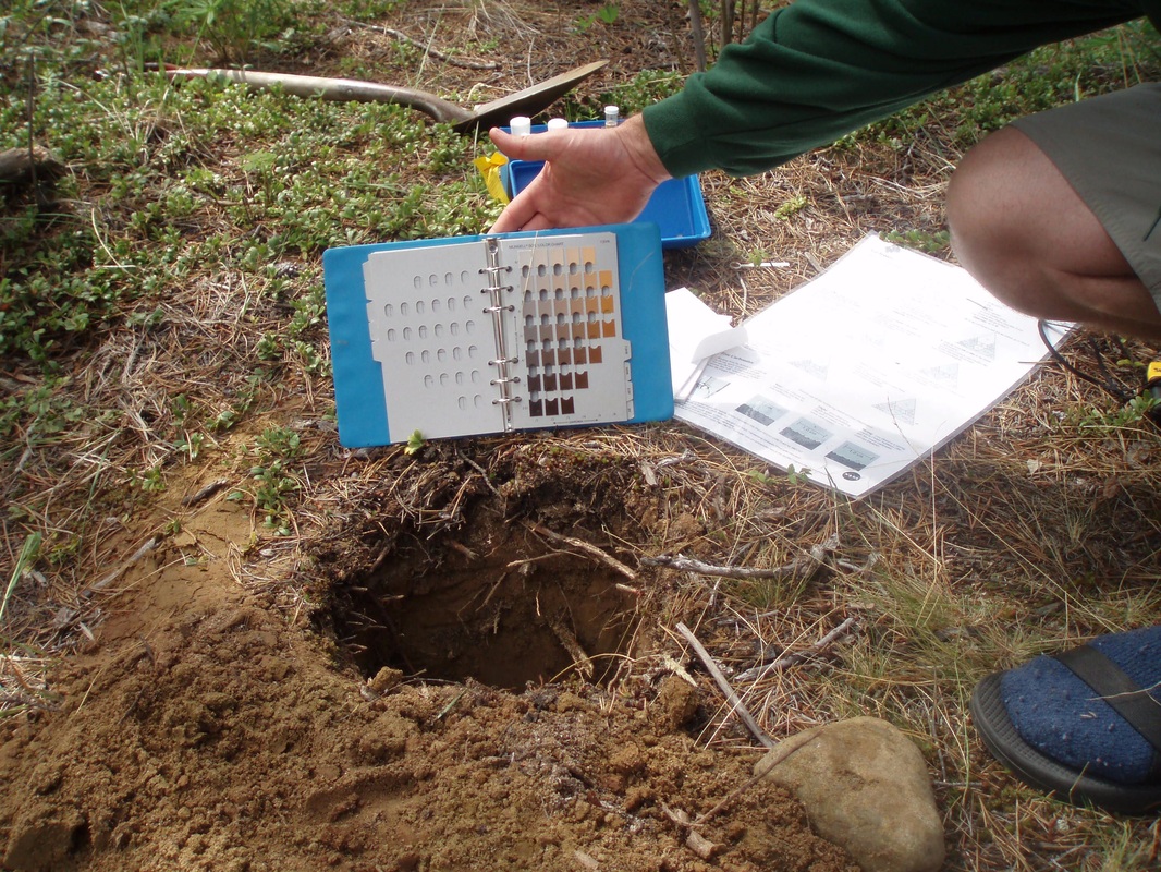
Identification of soil colour. Soil colour indicates the types of minerals found in a soil and indicates how soils were formed. To identify the soil colour take an undisturbed soil ped in your hand. Carefully break open the ped. If the soil is dry, carefully moisten the inside surface with a spray of water. Place the sample in a small plastic bag. Keep the soil sample in the sunlight. Look carefully at the colours on the soil colour chart on the back and compare them with your soil to decide the colour of your soil. Record your first and second choices for soil colour.
|
|
Consistence Consistence relates to the firmness of the individual peds and how easily they break apart.
Loose
Loose you have trouble picking out a single ped and the structure falls apart as soon as you touch it
|
Friable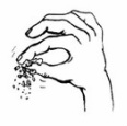
The ped breaks with a small amount of pressure
|
Firm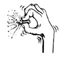
The ped breaks when you apply a good amount of pressure and
dents your fingers before it breaks |
Extremely Firm
The ped can't be crushed with your fingers you need a hammer
|
|
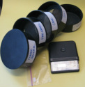
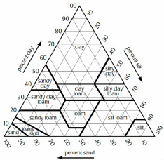
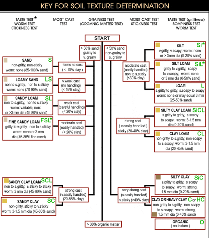
Measurement of soil texture
The amount of each sized particle (sand, silt or clay) in the soil is termed soil texture. To find soil texture, we use a graduated set of sieves and the following procedure.
|
|
- restack the sieves so sand then silt then the solid section on the bottom.
- pour the finer material into the top sieve and shake the sieves to sort the materials by size
- pour the materials from each sieve tray into a baggie then weigh the materials. This will give the proportional weights of sand silt and clay.
- using this proportion and the chart to the right, determine the soil texture.
|
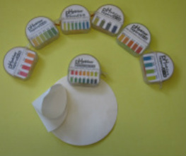
pH Measurements: pH of the soil affects the activity of the chemical elements in the soil, and so affects many soil properties. The following field method is used to determine soil pH.
|
|
Carbonates in SoilsCarbonates are materials that coat soil particles in soils that are above pH 7, especially in arid or semi-arid climates. Limestone and other materials with high calcium carbonate contents tend to buffer( neutralize) pH. The field test for calcium carbonate is to put drops of a mild solution of an acid (.5M HCl) on the material. If it contains calcium carbonate, bubbles will form.
Soil Moisture:
Soil acts like a sponge spread across the land surface. It absorbs rain and snowmelt, slows run-off and helps to control flooding. The absorbed water is held on soil particle surfaces and in pore spaces between particles. This water is available for use by plants during times of little precipitation. Some of this water evaporates back into the air; some drains through the soil into groundwater. Weight change method: A coarse sieved soil sample is placed in a container and weighed, The sample is then dried and weighed a second time, The weight change indicates the amount of water stored in the soil. The ratio of water to dry soil is called the soil water content.
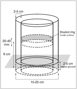
Infiltration rate: The soil infiltration rate is determined by measuring the time it takes for water sitting on a soil to drop a fixed distance. This rate changes with time as the soil pore spaces fill with water. There are three flow rates. Unsaturated flow is the initial flow rate and is high as the dry soil pore spaces fill with water. Saturated flow is a steady flow rate that occurs as water moves into the soil at a rate determined by soil texture and structure. Ponding is the flow rate that occurs when the ground becomes totally saturated and is no longer able to conduct water through its pores.Soil infiltration rate is a measure of the rate at which soil is able to absorb water. It is measured in millimeters per hour. The rate decreases as the soil becomes saturated. If the precipitation rate exceeds the infiltration rate, runoff will usually occur unless there is some physical barrier. Infiltration rate is determined by measuring the time it takes for water sitting on a soil to drop a fixed distance. This rate changes with time as the soil pore spaces fill with water. There are three flow rates. Unsaturated flow is the initial flow rate and is high as the dry soil pore spaces fill with water. Saturated flow is a steady flow rate that occurs as water moves into the soil at a rate determined by soil texture and structure. Ponding is the flow rate that occurs when the ground becomes totally saturated and is no longer able to conduct water through its pores.
Soil Moisture:
Soil acts like a sponge spread across the land surface. It absorbs rain and snowmelt, slows run-off and helps to control flooding. The absorbed water is held on soil particle surfaces and in pore spaces between particles. This water is available for use by plants during times of little precipitation. Some of this water evaporates back into the air; some drains through the soil into groundwater. Weight change method: A coarse sieved soil sample is placed in a container and weighed, The sample is then dried and weighed a second time, The weight change indicates the amount of water stored in the soil. The ratio of water to dry soil is called the soil water content.
Infiltration rate: The soil infiltration rate is determined by measuring the time it takes for water sitting on a soil to drop a fixed distance. This rate changes with time as the soil pore spaces fill with water. There are three flow rates. Unsaturated flow is the initial flow rate and is high as the dry soil pore spaces fill with water. Saturated flow is a steady flow rate that occurs as water moves into the soil at a rate determined by soil texture and structure. Ponding is the flow rate that occurs when the ground becomes totally saturated and is no longer able to conduct water through its pores.Soil infiltration rate is a measure of the rate at which soil is able to absorb water. It is measured in millimeters per hour. The rate decreases as the soil becomes saturated. If the precipitation rate exceeds the infiltration rate, runoff will usually occur unless there is some physical barrier. Infiltration rate is determined by measuring the time it takes for water sitting on a soil to drop a fixed distance. This rate changes with time as the soil pore spaces fill with water. There are three flow rates. Unsaturated flow is the initial flow rate and is high as the dry soil pore spaces fill with water. Saturated flow is a steady flow rate that occurs as water moves into the soil at a rate determined by soil texture and structure. Ponding is the flow rate that occurs when the ground becomes totally saturated and is no longer able to conduct water through its pores.
|
Using the Infiltrometer In the Field
|
|
Soil Fertility: A number of different kits are available for assessing soil fertility. Bring back a 200 ml soil sample from each soil layer. Be careful to lable each layer. These samples will be used in your lab to determine pH and fertility. The folowing is one method for calculating soil pH : For pH testing, samples should be collected from each soil horizon before the other soil tests are carried out. This will make sure that the soil is not contaminated with vinegar or tap water. Measure 40 ml of distilled water into a beaker. Test the pH of the water. Follow the instructions in the water pH pupil sheet. Using a spoon, weigh 40 g of dry soil and add to the distilled water in the beaker. Stir every three minutes for fifteen minutes. Allow the mixture to settle until there is a relatively clear layer of water on top of the soil. Dip the pH paper into the water for 20 seconds and repeat if necessary. Record the pH of the water and soil on the soil pH data sheet. Test three samples from each
|
